Skeda:CarlSaxET1877.jpg
Dokument origjinal ((përmasa 3.100 × 2.968 px, madhësia skedës: 7,57 MB, lloji MIME: image/jpeg))
| Kjo skedë është prej Wikimedia Commons dhe mund të përdoret nga projekte të tjera. Përshkrimi në këtë skedë në këtë faqe nuk është treguar më poshtë. | Shko tek faqja përshkruese në Commons |
Përmbledhje
| Përshkrimi |
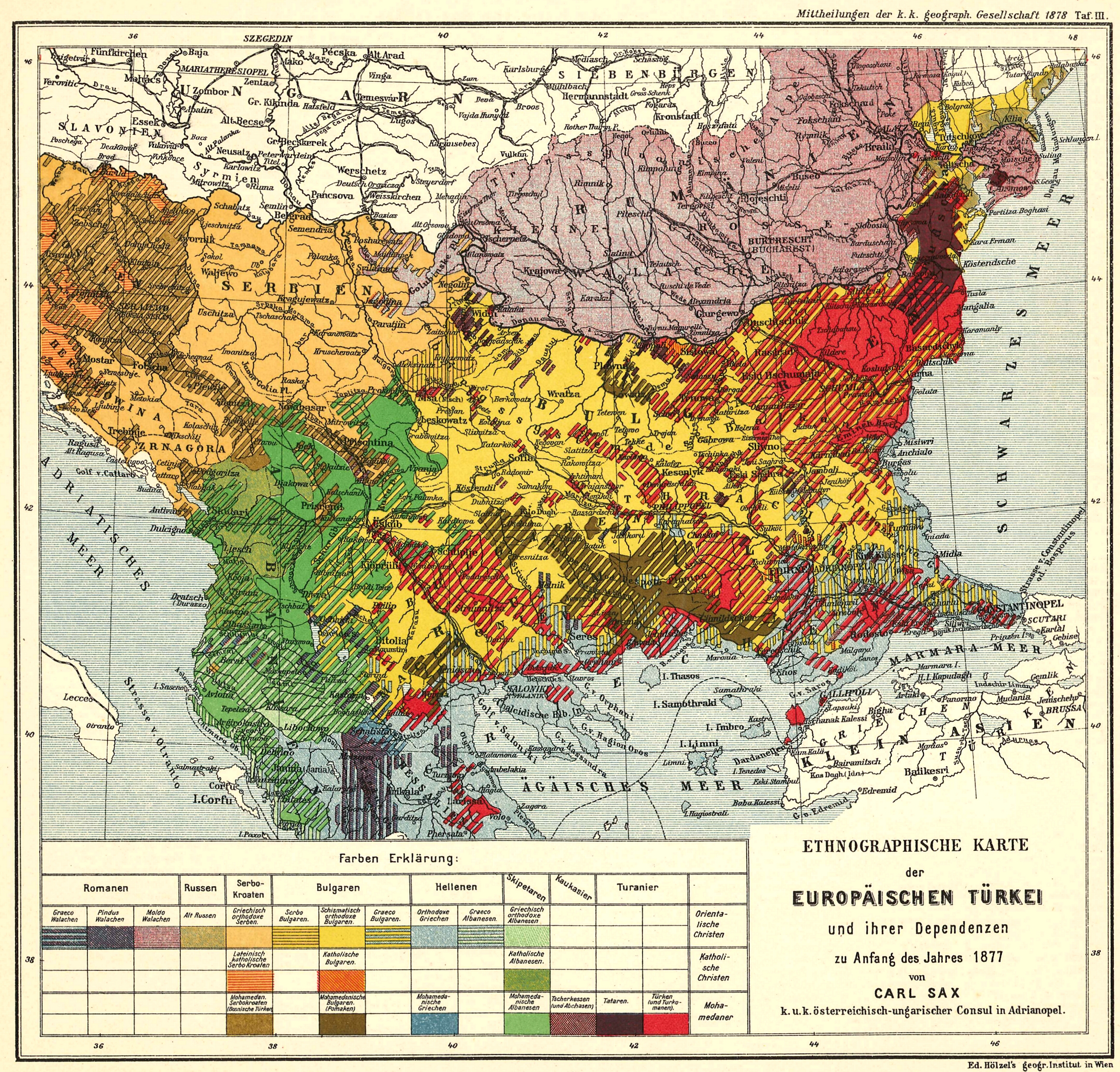
English: Ethnological Map of European Turkey and her Dependencies at the Time of the Beginning of the War of 1877, by Karl Sax, I. and R. Austro-Hungarian Consul at Adrianople. Published by the Imperial and Royal Geographical Society, Vienna 1878.
Български: Етнографска карта на Европейска Турция, автор: Карл Закс, 1877-1878 |
| Data | 1877 - 1878 |
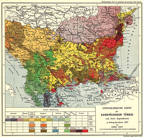
| Burimi | The Bulgarians in their historical, ethnographical and political frontiers, 1917 |
| Autori | Carl Sax |
Licencim
|
This work is in the public domain in its country of origin and other countries and areas where the copyright term is the author's life plus 70 years or fewer.
| |
| Kjo skedë është identifikuar si e lirë e kufizimeve të panjohura në ligjin e të drejtave të autorit, duke përfshirë të gjitha të drejtat e lidhura dhe fqinje. | |
Historiku skedës
Shtypni mbi një datë/kohë për ta parë skedën siç ishte atëherë.
| Data/Koha | Miniaturë | Përmasat | Përdoruesi | Koment | |
|---|---|---|---|---|---|
| e tanishme | 28 maj 2008 12:04 | | 3.100 × 2.968 (7,57 MB) | Alexandar.R.~commonswiki | {{Information |Description={{en|1=Ethnological Map of European Turkey and her Dependencies at the Time of the Beginning of the War of 1877, by Karl Sax, I. and R. Austro-Hungarian Consul at Adrianople. Publisched by the Imperial and Royal Geographical Soc |
Lidhje skedash
Këto faqe lidhen tek kjo skedë:
Përdorimi global i skedës
Kjo skedë përdoret nga Wiki të tjera në vijim:
- Përdorimi në ba.wikipedia.org
- Përdorimi në bg.wikipedia.org
- Përdorimi në cv.wikipedia.org
- Përdorimi në de.wikipedia.org
- Përdorimi në en.wikipedia.org
- Demographic history of Macedonia
- Talk:Albanians in North Macedonia
- History of the Bulgarian language
- Bulgarian Turks
- Albanians in Serbia
- Wikipedia:Articles for deletion/Log/2010 April 29
- Wikipedia:Articles for deletion/Genocide of Ottoman Turks and Muslims
- Talk:Albanians/Archive 3
- User:Falcaorib
- Circassians in Romania
- Përdorimi në et.wikipedia.org
- Përdorimi në hu.wikipedia.org
- Përdorimi në it.wikipedia.org
- Përdorimi në pnb.wikipedia.org
- Përdorimi në ro.wikipedia.org
- Përdorimi në ru.wikipedia.org
- Përdorimi në sr.wikipedia.org
- Përdorimi në tr.wikipedia.org
- Përdorimi në ur.wikipedia.org