Skeda:Downtown Omaha from the North at Night.jpg

Madhësia e këtij shikimi: 800 × 450 pixel. Rezolucione të tjera: 320 × 180 pixel | 640 × 360 pixel | 1.024 × 576 pixel | 1.280 × 720 pixel | 2.656 × 1.494 pixel.
Dokument origjinal ((përmasa 2.656 × 1.494 px, madhësia skedës: 3,53 MB, lloji MIME: image/jpeg))
| Kjo skedë është prej Wikimedia Commons dhe mund të përdoret nga projekte të tjera. Përshkrimi në këtë skedë në këtë faqe nuk është treguar më poshtë. | Shko tek faqja përshkruese në Commons |
Përmbledhje
| Camera location | | View this and other nearby images on: OpenStreetMap |
|---|
| Përshkrimi |
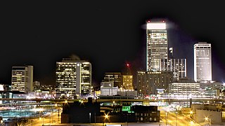
English: Long exposure of Downtown Omaha at night looking south. |
| Data | |
| Burimi | Punë e juaja |
| Autori | Patrick Hawks |
| Versione tjera |
|

Licencim
Unë, krijuesi i kësaj pune, e publikoj këtu në bazë të licensës në vijim:
This file is licensed under the Creative Commons Attribution license, versions 1.0, 2.0, 2.5, 3.0, 4.0 and any later version released by Creative Commons. You may select the version of your choice. In short: you are free to share and make derivative works of the file under the conditions that you appropriately attribute it. Official license: 1.0, 2.0, 2.5, 3.0, 4.0
|
If this file was uploaded before Jan. 10th, 2013 it is licensed under:
Kjo skedë është dhënë për përdorim sipas licensës Creative Commons Attribution 3.0 Unported, 2.5 Generic, 2.0 Generic dhe 1.0 Generic.
- Je i lirë të:
- ta shpërndani – ta kopjoni, rishpërndani dhe përcillni punën
- t’i bëni “remix” – të përshtatni punën
- Sipas kushteve të mëposhtme:
- atribuim – Duhet t’i jepni meritat e duhura, të siguroni një lidhje për tek licenca dhe të tregoni nëse janë bërë ndryshime. Këtë mund ta bëni në ndonjë mënyrë të arsyeshme, por jo në ndonjë mënyrë që sugjeron se licencuesi ju del zot juve apo përdorimit tuaj.
Historiku skedës
Shtypni mbi një datë/kohë për ta parë skedën siç ishte atëherë.
| Data/Koha | Miniaturë | Përmasat | Përdoruesi | Koment | |
|---|---|---|---|---|---|
| e tanishme | 4 qershor 2012 19:23 | | 2.656 × 1.494 (3,53 MB) | Pat Hawks |
Lidhje skedash
Këto faqe lidhen tek kjo skedë:
Përdorimi global i skedës
Kjo skedë përdoret nga Wiki të tjera në vijim:
- Përdorimi në en.wikipedia.org
- Përdorimi në fi.wikipedia.org
- Përdorimi në hy.wikipedia.org
- Përdorimi në incubator.wikimedia.org
- Përdorimi në nl.wikinews.org
- Përdorimi në pt.wikipedia.org