Skeda:Madagascar location map.svg

Size of this PNG preview of this SVG file: 330 × 599 pixel. Rezolucione të tjera: 132 × 240 pixel | 264 × 480 pixel | 423 × 768 pixel | 564 × 1.024 pixel | 1.128 × 2.048 pixel | 803 × 1.458 pixel.
Dokument origjinal (skedë SVG, fillimisht 803 × 1.458 pixel, madhësia e skedës: 434 KB)
| Kjo skedë është prej Wikimedia Commons dhe mund të përdoret nga projekte të tjera. Përshkrimi në këtë skedë në këtë faqe nuk është treguar më poshtë. | Shko tek faqja përshkruese në Commons |
Përmbledhje
| Përshkrimi |
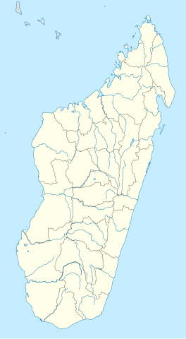
Deutsch: Positionskarte von Madagaskar
Quadratische Plattkarte, N-S-Streckung 105 %. Geographische Begrenzung der Karte:
English: Location map of Madagascar
Equirectangular projection, N/S stretching 105 %. Geographic limits of the map:
|
| Data | |
| Burimi |
own work, using
|
| Autori | NordNordWest |

|
This map has been made or improved in the German Kartenwerkstatt (Map Lab). You can propose maps to improve as well.
|
Licencim
Unë, krijuesi i kësaj pune, e publikoj këtu në bazë të licensës në vijim:

|
Ju jepet leje për ta kopjuar, shpërndarë dhe/ose ndryshuar këtë dokument sipas kushteve të Licencës GNU për Dokumentim të Lirë, versioni 1.2 ose çfarëdo versioni të mëpasshëm të botuar nga Free Software Foundation; pa Seksione të Pandryshueshme, pa Tekste Kapakësh të Përparmë, dhe pa Tekste Kapakësh të Pasmë. Një kopje e kësaj licence është përfshirë në seksionin e titulluar GNU Free Documentation License. |
Kjo skedë licencohet sipas Creative Commons Attribution-Share Alike 3.0 Unported.
- Je i lirë të:
- ta shpërndani – ta kopjoni, rishpërndani dhe përcillni punën
- t’i bëni “remix” – të përshtatni punën
- Sipas kushteve të mëposhtme:
- atribuim – Duhet t’i jepni meritat e duhura, të siguroni një lidhje për tek licenca dhe të tregoni nëse janë bërë ndryshime. Këtë mund ta bëni në ndonjë mënyrë të arsyeshme, por jo në ndonjë mënyrë që sugjeron se licencuesi ju del zot juve apo përdorimit tuaj.
- share alike – Nëse bëni një “remix”, e shndërroni, ose ndërtoni duke u bazuar te materiali, duhet t’i shpërndani kontributet tuaja sipas të njëjtës licencë ose një të tille të përputhshme me origjinalen.
Mundeni të përzgjidhni licencën që doni.
Historiku skedës
Shtypni mbi një datë/kohë për ta parë skedën siç ishte atëherë.
| Data/Koha | Miniaturë | Përmasat | Përdoruesi | Koment | |
|---|---|---|---|---|---|
| e tanishme | 23 shtator 2009 17:51 | | 803 × 1.458 (434 KB) | NordNordWest | |
| 14 tetor 2008 21:26 |  | 803 × 1.458 (368 KB) | NordNordWest | {{Information |Description= {{de|Positionskarte von Madagaskar}} Quadratische Plattkarte, N-S-Streckung 105 %. Geographische Begrenzung der Karte: * N: 11.3° S * S: 26.0° S * W: 42.5° O * O: 51.0° O {{en|Location map of [[:en:Madaga |
Lidhje skedash
Këto faqe lidhen tek kjo skedë:
Përdorimi global i skedës
Kjo skedë përdoret nga Wiki të tjera në vijim:
- Përdorimi në af.wikipedia.org
- Përdorimi në am.wikipedia.org
- Përdorimi në an.wikipedia.org
- Përdorimi në ar.wikipedia.org
- Përdorimi në ast.wikipedia.org
- Përdorimi në azb.wikipedia.org
- ماداقاسکار دؤیوشو
- تواماسینا
- تولیارا
- امبوهیمالزا، سامباوا
- امبینانیفاهو
- تلانارو
- امبالوائو
- امباتولامپی
- امبودیهارینا
- امپاهانا
- امپوهیب
- اموهیترالانانا
- امبلآباد، آنتالیا
- ماروفناریتا
- امبالانیرانا
- امبانقو
- امبالاواتو
- انداینقو
- امپاسیپاتسی قار
- انداسیب، مورامانقا
- امبوهیماندراس، امبالاوائو
- امباتولاوا
- امباتوندرازاک سابرباین
- امباتولای، مایندریوازو
- امباریمانینقا
- انالالیری
- امبواساری، مورامانقا
- امبوانقیب
- امبوتاکا
- امبوهیدرونانو
- وسینا
- امباکرینی
- امبالاسوا
Shikoni më shumë përdorim global të kësaj skede.