Skeda:Bratislava Region - physical map.png

Madhësia e këtij shikimi: 494 × 600 pixel. Rezolucione të tjera: 198 × 240 pixel | 560 × 680 pixel.
Dokument origjinal ((përmasa 560 × 680 px, madhësia skedës: 1,09 MB, lloji MIME: image/png))
| Kjo skedë është prej Wikimedia Commons dhe mund të përdoret nga projekte të tjera. Përshkrimi në këtë skedë në këtë faqe nuk është treguar më poshtë. | Shko tek faqja përshkruese në Commons |
| Përshkrimi |
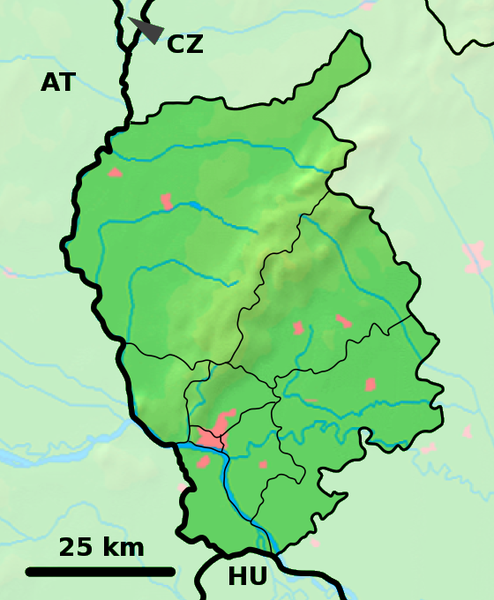
Background map of the Bratislava Region, Slovakia, ready for the Geobox template, calibrated at en:Template:Geobox locator Bratislava Region Outline map of the Bratislava Region, Slovakia, ready for the Geobox template, calibrated at en:Template:Geobox locator Bratislava Region |
| Data | (UTC) |
| Burimi | |
| Autori |
|
| This is a retouched picture, which means that it has been digitally altered from its original version. Modifications: fusion. The original can be viewed here: Bratislava Region - outline map.svg:
|
Kjo skedë licencohet sipas Creative Commons Attribution-Share Alike 3.0 Unported.
- Je i lirë të:
- ta shpërndani – ta kopjoni, rishpërndani dhe përcillni punën
- t’i bëni “remix” – të përshtatni punën
- Sipas kushteve të mëposhtme:
- atribuim – Duhet t’i jepni meritat e duhura, të siguroni një lidhje për tek licenca dhe të tregoni nëse janë bërë ndryshime. Këtë mund ta bëni në ndonjë mënyrë të arsyeshme, por jo në ndonjë mënyrë që sugjeron se licencuesi ju del zot juve apo përdorimit tuaj.
- share alike – Nëse bëni një “remix”, e shndërroni, ose ndërtoni duke u bazuar te materiali, duhet t’i shpërndani kontributet tuaja sipas të njëjtës licencë ose një të tille të përputhshme me origjinalen.
Regjistri origjinal i ngarkimeve
This image is a derivative work of the following images:
- File:Bratislava_Region_-_background_map.png licensed with PD-Demis
- 2007-10-28T23:14:11Z Caroig 560x680 (333118 Bytes) fixing alignment
- 2007-10-27T19:44:14Z Caroig 560x680 (335827 Bytes) == Summary == {{Information |Description=Background map of the Bratislava Region, Slovakia, ready for the [[:en:Template:Geobox|Geobox]] template, calibrated at [[:en:Template:Geobox locator Bratislava Region]] |Source=Made m
- File:Bratislava_Region_-_outline_map.svg licensed with Cc-by-sa-3.0,2.5,2.0,1.0, GFDL
- 2007-10-27T19:47:14Z Caroig 700x850 (120252 Bytes) == Summary == {{Information |Description=Outline map of the Bratislava Region, Slovakia, ready for the [[:en:Template:Geobox|Geobox]] template, calibrated at [[:en:Template:Geobox locator Bratislava Region]] |Source=self-made
Uploaded with derivativeFX
Historiku skedës
Shtypni mbi një datë/kohë për ta parë skedën siç ishte atëherë.
| Data/Koha | Miniaturë | Përmasat | Përdoruesi | Koment | |
|---|---|---|---|---|---|
| e tanishme | 19 shtator 2010 20:01 | | 560 × 680 (1,09 MB) | Adehertogh | {{Information |Description=Background map of the Bratislava Region, Slovakia, ready for the Geobox template, calibrated at en:Template:Geobox locator Bratislava Region Outline map of the Bratislava Region, Slovakia, ready for |
Lidhje skedash
S’ka faqe që përdorin këtë kartelë.
Përdorimi global i skedës
Kjo skedë përdoret nga Wiki të tjera në vijim:
- Përdorimi në bg.wikipedia.org
- Përdorimi në en.wikipedia.org
- Pezinok
- Gajary
- Malacky
- Petržalka
- Modra
- Svätý Jur
- Dunajská Lužná
- Senec, Slovakia
- Vysoká pri Morave
- Jakubov
- Kostolište
- Suchohrad
- Jablonové, Malacky District
- Pernek
- Kuchyňa
- Rusovce
- Jarovce
- Blatné
- Rohožník, Malacky District
- Borinka
- Zohor
- Láb
- Lozorno
- Marianka
- Plavecké Podhradie
- Plavecký Mikuláš
- Plavecký Štvrtok
- Sološnica
- Studienka
- Veľké Leváre
- Závod, Slovakia
- Budmerice
- Báhoň
- Doľany, Pezinok District
- Dubová, Pezinok District
- Jablonec, Pezinok District
- Slovenský Grob
- Vinosady
- Limbach, Slovakia
- Viničné
- Vištuk
- Štefanová, Pezinok District
- Šenkvice
- Častá
- Bernolákovo
- Boldog, Slovakia
Shikoni më shumë përdorim global të kësaj skede.