Skeda:Guatemala location map.svg

Size of this PNG preview of this SVG file: 545 × 599 pixel. Rezolucione të tjera: 218 × 240 pixel | 436 × 480 pixel | 698 × 768 pixel | 931 × 1.024 pixel | 1.862 × 2.048 pixel | 982 × 1.080 pixel.
Dokument origjinal (skedë SVG, fillimisht 982 × 1.080 pixel, madhësia e skedës: 120 KB)
| Kjo skedë është prej Wikimedia Commons dhe mund të përdoret nga projekte të tjera. Përshkrimi në këtë skedë në këtë faqe nuk është treguar më poshtë. | Shko tek faqja përshkruese në Commons |
Përmbledhje
| Përshkrimi |
Deutsch: Positionskarte von Guatemala
Quadratische Plattkarte Русский: Карта расположения Гватемалы
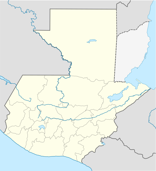
English: Location map of Guatemala
Equirectangular projection, Geographic limits of the map:
Հայերեն: Գվատեմալայի տեղորոշման քարտեզ
Ուղղանկյուն պրոյեկցիա։ Քարտեզում աշխարհագրական սահմանները.
|
||
| Data | |||
| Burimi | |||
| Autori |
|
||
| SVG genesis | This W3C-invalid vector image was created with Adobe Illustrator, and with Inkscape.
|
Licencim
Kjo skedë licencohet sipas Creative Commons Attribution-Share Alike 3.0 Unported.
- Je i lirë të:
- ta shpërndani – ta kopjoni, rishpërndani dhe përcillni punën
- t’i bëni “remix” – të përshtatni punën
- Sipas kushteve të mëposhtme:
- atribuim – Duhet t’i jepni meritat e duhura, të siguroni një lidhje për tek licenca dhe të tregoni nëse janë bërë ndryshime. Këtë mund ta bëni në ndonjë mënyrë të arsyeshme, por jo në ndonjë mënyrë që sugjeron se licencuesi ju del zot juve apo përdorimit tuaj.
- share alike – Nëse bëni një “remix”, e shndërroni, ose ndërtoni duke u bazuar te materiali, duhet t’i shpërndani kontributet tuaja sipas të njëjtës licencë ose një të tille të përputhshme me origjinalen.
Regjistri origjinal i ngarkimeve
This image is a derivative work of the following images:
- File:Guatemala Departments.svg licensed with Cc-by-sa-3.0, Cc-by-sa-3.0/ru, GFDL
- 2009-10-24T20:10:21Z Daryona 982x1080 (139456 Bytes) {{Information |Description={{en|1=Guatemala map}} {{ru|1=Карта гватемалы с департаментами}} |Source={{own}} |Author=[[User:Daryona|Daryona]] |Date=2009-10-24 |Permission= |other_versions= }} [[Ca
- File:Mexico location map.svg licensed with Cc-by-3.0, GFDL
- 2009-03-11T18:34:05Z NordNordWest 2029x1326 (882028 Bytes) {{Information |Description= {{de|Positionskarte von [[:de:Mexiko|Mexiko]]}} Quadratische Plattkarte, N-S-Streckung 110 %. Geographische Begrenzung der Karte: * N: 33.3° N * S: 14.2° N * W: 118.5° W * O: 86.3° W {{en|Locat
Uploaded with derivativeFX
Historiku skedës
Shtypni mbi një datë/kohë për ta parë skedën siç ishte atëherë.
| Data/Koha | Miniaturë | Përmasat | Përdoruesi | Koment | |
|---|---|---|---|---|---|
| e tanishme | 18 tetor 2022 21:11 | | 982 × 1.080 (120 KB) | Janitoalevic | Fixing |
| 18 tetor 2022 20:59 |  | 982 × 1.080 (102 KB) | Janitoalevic | Added disputed territory | |
| 26 tetor 2009 23:05 |  | 982 × 1.080 (154 KB) | Spischot | {{Information |Description={{de|Positionskarte von Guatemala}} Quadratische Plattkarte {{en|Location map of Guatemala}} Equirectangular projection, Geographic limits of the map: * N: 18.05° N * S: 13.54° N * W: 9 |
Lidhje skedash
Këto faqe lidhen tek kjo skedë:
Përdorimi global i skedës
Kjo skedë përdoret nga Wiki të tjera në vijim:
- Përdorimi në af.wikipedia.org
- Përdorimi në an.wikipedia.org
- Përdorimi në ar.wikipedia.org
- Përdorimi në ast.wikipedia.org
- Puerto San José
- San Pedro Sacatepéquez (Guatemala)
- Ciudá de Guatemala
- Volcán Santa María
- Volcán de Fueu
- Módulu:Mapa de llocalización/datos/Guatemala/usu
- Uaxactún
- Quiriguá
- Terremotu de Guatemala de 1902
- Campusantu de la Ciudá de Guatemala
- Aeropuertu Bananera
- Aeropuertu de Coatepeque
- Aeropuertu de Cobán
- Aeropuertu de Huehuetenango
- Aeropuertu de Playa Grande
- Aeropuertu de Puerto Barrio
- Aeropuertu de Puerto San José
- Aeropuertu de Quetzaltenango
- Aeropuertu de Quiché
- Aeropuertu de Retalhuleu
- Puerto Barrio
- Puertu Quetzal
- Santo Tomás de Castilla
- Plantía:Mapa de llocalización de Guatemala
- Volcán San Pedro (Guatemala)
- Përdorimi në az.wikipedia.org
- Përdorimi në ba.wikipedia.org
- Përdorimi në be-tarask.wikipedia.org
- Përdorimi në be.wikipedia.org
- Përdorimi në bg.wikipedia.org
- Përdorimi në bn.wikipedia.org
- Përdorimi në bs.wikipedia.org
Shikoni më shumë përdorim global të kësaj skede.