Skeda:India Tripura locator map.svg

Dokument origjinal (skedë SVG, fillimisht 1.574 × 1.738 pixel, madhësia e skedës: 836 KB)
| Kjo skedë është prej Wikimedia Commons dhe mund të përdoret nga projekte të tjera. Përshkrimi në këtë skedë në këtë faqe nuk është treguar më poshtë. | Shko tek faqja përshkruese në Commons |
| Titulli |
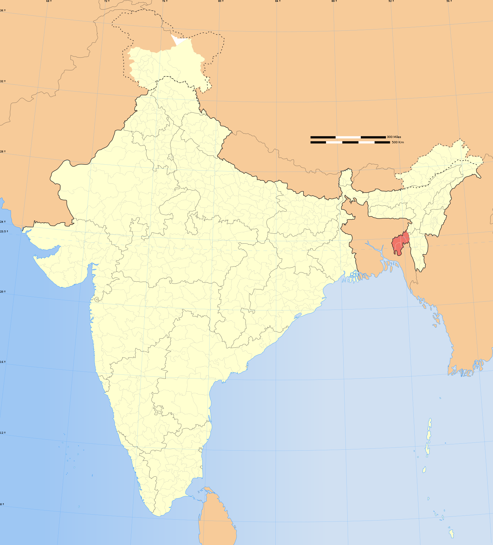
Tripura locator map |
|||||||||
| Përshkrimi |
Locator map of the state of Tripura, India with district boundaries. |
|||||||||
| Map legend |
 |
|||||||||
| Data | ||||||||||
| Burimi |
Punë e juaja |
|||||||||
| Krijues |
|
|||||||||
| Leja (Ripërdor këtë skedë) |
Unë, krijuesi i kësaj pune, e publikoj këtu në bazë të licensës në vijim: Kjo skedë licencohet sipas Creative Commons Attribution-Share Alike 3.0 Unported.
|
|||||||||
| Geotemporal data | ||||||||||
| Date depicted | second half of 20 century dhe 21 century | |||||||||
| Spatial reference system | conic | |||||||||
| Bounding box |
|
|||||||||
| Georeferencing | If inappropriate please set warp_status = skip to hide. | |||||||||
| Archival data | ||||||||||
| Notes | Part of WikiProject India Maps | |||||||||
| Versione tjera |
|
|||||||||


Notes
Depiction of India's borders
- The territorial boundaries of India are shown as per the actual ground situation in accordance with international practices followed by the United Nations ([1], [2]) and the National Geographic Society ([3], [4])
- This map is meant to be for illustrative purpose only and is not authenticated by official government sources. Please check the list of sources and references used to create the map for a measure of accuracy and verifiability.
- The usage of these maps in India, Pakistan and China are governed by different laws that restrict depictions of boundaries other than what is officially recognized by the state. Please check local laws and modify the map accordingly before use.
Explanation of disputed boundaries


- Boundary of Indian claim : The territory India claims is legally theirs, but the claim is disputed by China and Pakistan.
- Line of Control/Line of Conflict : The de facto administrative boundary recognised by the international community. This UN ceasefire line is considered as a temporary solution to an ongoing conflict since the departure of the British Raj.
Borders of disputed regions
The depicted extent of the former territory of the British Indian Empire, succeeded by Republic of India, may not be accepted by few countries as legal due to ongoing border disputes:
- The northern Himalayan region of the disputed territory Indian-administered Kashmir is claimed by India including (Pakistan-administered Kashmir) and the Chinese-occupied territory of (Ladakh plateau). Since 1972, it is divided between all three countries. See also Line of Control and Line of Actual Control.
- Siachen glacier (shown white) is an actively contested region between India and Pakistan. Since 1984, the region is under Indian control.
- The northeastern territory of Arunachal Pradesh is almost entirely claimed by China as part of its Tibetan territory.
- Minor areas of eastern Kashmir's Ladakh division, Himachal Pradesh and Uttarakhand on the Chinese frontier are claimed by China. These areas are under Indian control.
- A small area of Uttarakhand adjoining the Nepal border along the Sarda river is disputed between the two countries.
For a detailed map of all disputed regions in South Asia, see Image:India disputed areas map.svg
Internal borders
The borders of the state of Meghalaya, Assam and Arunachal Pradesh are shown as interpreted from the North-Eastern Areas (Reorganisation) Act, 1971, but has yet to be verified.
Territorial waters
The limit of the territorial waters of India extends to twelve nautical miles measured from the appropriate baseline. See this for more information.
Historiku skedës
Shtypni mbi një datë/kohë për ta parë skedën siç ishte atëherë.
| Data/Koha | Miniaturë | Përmasat | Përdoruesi | Koment | |
|---|---|---|---|---|---|
| e tanishme | 29 dhjetor 2008 09:11 | | 1.574 × 1.738 (836 KB) | Planemad | {{Information |Description= |Source= |Date= |Author= |Permission= |other_versions= }} |
| 6 gusht 2006 20:04 |  | 1.639 × 1.852 (751 KB) | Planemad | {{WikiProject_India_Maps |Title=Tripura locator map |Description=Locator map of the state of Tripura, India with district boundaries. |Source=. |Date=August 6 2006 |Author=w:user:Nichalpw:user:Planemad |Thumbdir=CHANGE }} |
Lidhje skedash
Këto faqe lidhen tek kjo skedë:
Përdorimi global i skedës
Kjo skedë përdoret nga Wiki të tjera në vijim:
- Përdorimi në ar.wikipedia.org
- Përdorimi në as.wikipedia.org
- Përdorimi në awa.wikipedia.org
- Përdorimi në ba.wikipedia.org
- Përdorimi në be.wikipedia.org
- Përdorimi në bg.wikipedia.org
- Përdorimi në bh.wikipedia.org
- Përdorimi në bn.wikipedia.org
- Përdorimi në br.wikipedia.org
- Përdorimi në ceb.wikipedia.org
- Përdorimi në cs.wikipedia.org
- Përdorimi në da.wikipedia.org
- Përdorimi në de.wikipedia.org
- Përdorimi në en.wikipedia.org
- Wikipedia:WikiProject India
- Wikipedia:WikiProject Tripura
- Template:User interest India
- Template:User interest India/doc
- Template:User WP India
- Template:User WP India/doc
- Wikipedia:Userboxes/Location/India
- Template:User in India
- Template:User in India/doc
- Template:User in Tripura
- Template:User in Tripura/doc
- Template:User WP Tripura
- Template:User WP Tripura/doc
- Template:User interest Tripura
- Template:User interest Tripura/doc
- Template:User citizen India
- Template:User citizen India/doc
- Template:User citizen Tripura
- Template:User citizen Tripura/doc
- Template:User from India
- Template:User from India/doc
- Template:User from Tripura
- Category:WikiProject Tripura participants
- Template:User from Tripura/doc
- Category:Wikipedians in Tripura
- Template:User India/doc1
- Template:User Tripura/doc1
- Wikipedia:Userboxes/Life/Ethnicity/02
- Category:Wikipedians interested in Tripura
- Template:User proud Indian
- Template:User proud Indian/doc
- Wikipedia:WikiProject India/Templates
- Wikipedia:WikiProject India/userbox templates
- User:Abel Tiprasa
- User:Chandrakant Sarkar
- User:Buaidh/Test7
Shikoni më shumë përdorim global të kësaj skede.