Skeda:Map of USA HI full.png
Nuk ka përmasa më të madhaja.
Map_of_USA_HI_full.png ((përmasa 286 × 186 px, madhësia skedës: 21 KB, lloji MIME: image/png))
| Kjo skedë është prej Wikimedia Commons dhe mund të përdoret nga projekte të tjera. Përshkrimi në këtë skedë në këtë faqe nuk është treguar më poshtë. | Shko tek faqja përshkruese në Commons |
Përmbledhje

|
File:Map of USA HI full.svg is a vector version of this file. It should be used in place of this PNG file when not inferior.
File:Map of USA HI full.png → File:Map of USA HI full.svg
For more information, see Help:SVG. |
 |
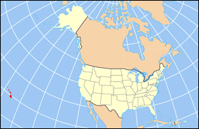
| Përshkrimi | Map of USA with Hawaii highlighted and shown in true position |
| Burimi | http://www.nationalatlas.gov/printable/reference.html |
| Autori |
Licencim
This map was obtained from an edition of the National Atlas of the United States. Like almost all works of the U.S. federal government, works from the National Atlas are in the public domain in the United States.
Online access: NationalAtlas.gov | 1970 print edition: Library of Congress, Perry-Castañeda Library
|
Historiku skedës
Shtypni mbi një datë/kohë për ta parë skedën siç ishte atëherë.
| Data/Koha | Miniaturë | Përmasat | Përdoruesi | Koment | |
|---|---|---|---|---|---|
| e tanishme | 2 prill 2007 18:30 | | 286 × 186 (21 KB) | MattWright | fix to more standard map colors |
| 1 prill 2007 21:09 |  | 286 × 186 (19 KB) | MattWright | {{Information |Description=Map of USA with Hawaii highlighted and shown in true position |Source=http://www.nationalatlas.gov/printable/reference.html |Date= |Author= |Permission= |other_versions= }} Category:Maps of the United States [[Category:Maps |
Lidhje skedash
S’ka faqe që përdorin këtë kartelë.
Përdorimi global i skedës
Kjo skedë përdoret nga Wiki të tjera në vijim:
- Përdorimi në bcl.wikipedia.org
- Përdorimi në bo.wikipedia.org
- Përdorimi në da.wikipedia.org
- Përdorimi në en.wikipedia.org
- Përdorimi në es.wikipedia.org
- Përdorimi në fa.wikipedia.org
- Përdorimi në hu.wikipedia.org
- Përdorimi në id.wikipedia.org
- Përdorimi në ja.wikipedia.org
- Përdorimi në ko.wikipedia.org
- Përdorimi në mrj.wikipedia.org
- Përdorimi në mr.wikipedia.org
- Përdorimi në pl.wikipedia.org
- Përdorimi në pl.wikinews.org
- Përdorimi në pl.wiktionary.org
- Përdorimi në ro.wikipedia.org
- Përdorimi në sv.wikipedia.org
- Përdorimi në uk.wikipedia.org
Shikoni më shumë përdorim global të kësaj skede.