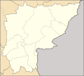
Skeda:Thailand Sa Kaeo location map.svg

Size of this PNG preview of this SVG file: 666 × 599 pixel. Rezolucione të tjera: 267 × 240 pixel | 534 × 480 pixel | 854 × 768 pixel | 1.138 × 1.024 pixel | 2.276 × 2.048 pixel | 1.595 × 1.435 pixel.
Dokument origjinal (skedë SVG, fillimisht 1.595 × 1.435 pixel, madhësia e skedës: 568 KB)
Historiku skedës
Shtypni mbi një datë/kohë për ta parë skedën siç ishte atëherë.
| Data/Koha | Miniaturë | Përmasat | Përdoruesi | Koment | |
|---|---|---|---|---|---|
| e tanishme | 20 qershor 2020 21:31 |  | 1.595 × 1.435 (568 KB) | ZeroSixTwo | Uploaded a work by Hdamm for the original map<br>ZeroSixTwo for recolouring from {{Created with Inkscape}} {{AttribSVG|Amphoe Sa Kaeo.svg|Hdamm}} with UploadWizard |
Lidhje skedash
S’ka faqe që përdorin këtë kartelë.
Përdorimi global i skedës
Kjo skedë përdoret nga Wiki të tjera në vijim:
- Përdorimi në fr.wikipedia.org
- Përdorimi në id.wikipedia.org
- Përdorimi në th.wikipedia.org
- รายชื่อโรงเรียนในจังหวัดสระแก้ว
- เทศบาลเมืองวังน้ำเย็น
- อุทยานประวัติศาสตร์สด๊กก๊อกธม
- เทศบาลเมืองสระแก้ว
- ตำบลวังสมบูรณ์
- เทศบาลเมืองอรัญญประเทศ
- มอดูล:Location map/data/Thailand Sa Kaeo
- มอดูล:Location map/data/Thailand Sa Kaeo/doc
- ตำบลบ้านแก้ง (อำเภอเมืองสระแก้ว)
- ศูนย์ที่พักพิงชั่วคราวสำหรับผู้หลบหนีเข้าเมืองจากกัมพูชาเขาอีด่าง
- ค่ายผู้อพยพหนองจาน
- ค่ายผู้อพยพหนองเสม็ด
- ค่ายผู้อพยพสระแก้ว
- พื้นที่อพยพที่ 2