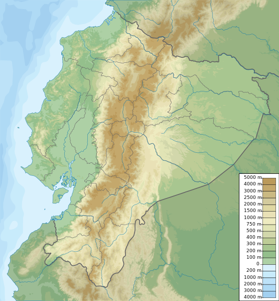
Skeda:Ecuador relief location map.svg

Size of this PNG preview of this SVG file: 556 × 599 pixel. Rezolucione të tjera: 223 × 240 pixel | 445 × 480 pixel | 713 × 768 pixel | 950 × 1.024 pixel | 1.901 × 2.048 pixel | 851 × 917 pixel.
Dokument origjinal (skedë SVG, fillimisht 851 × 917 pixel, madhësia e skedës: 3,76 MB)
| Kjo skedë është prej Wikimedia Commons dhe mund të përdoret nga projekte të tjera. Përshkrimi në këtë skedë në këtë faqe nuk është treguar më poshtë. | Shko tek faqja përshkruese në Commons |
Përmbledhje
| Përshkrimi | Ecuador physical map, parameters equal to File:Ecuador location map.svg |
| Data | |
| Burimi | Punë e juaja |
| Autori | Urutseg |
Licencim
Unë, krijuesi i kësaj pune, e publikoj këtu në bazë të licensës në vijim:
| Kjo skedë është bërë e mundur nën Creative Commons CC0 1.0 Universal Public Domain Dedication. | |
| Personi që lidhi një punë me këtë vepër ia ka dedikuar punën public domain duke shmangur të gjitha të drejtat e tij apo të saj për punën në mbarë botën nën ligjin e të drejtës së autorit, duke përfshirë të gjitha të drejtat e lidhura dhe fqinje, deri në masën e lejuar me ligj. Ju mund ta kopjoni, modifikoni, shpërndani dhe të kryeni pune, madje edhe për qëllime komerciale, të gjitha pa kërkuar leje.
|
Historiku skedës
Shtypni mbi një datë/kohë për ta parë skedën siç ishte atëherë.
| Data/Koha | Miniaturë | Përmasat | Përdoruesi | Koment | |
|---|---|---|---|---|---|
| e tanishme | 15 tetor 2012 21:49 | | 851 × 917 (3,76 MB) | Milenioscuro | corrections of coastal line and boundaries (according to Ecuador location map.svg) |
| 26 gusht 2012 17:16 |  | 1.536 × 1.654 (2,49 MB) | Joffrenomuere | son 24 Provincias no 22 | |
| 15 qershor 2012 10:04 |  | 851 × 917 (2,13 MB) | TUBS | rv: please follow map conventions, cf your disk | |
| 13 qershor 2012 20:53 |  | 851 × 917 (2,35 MB) | Joffrenomuere | 24 provincias | |
| 14 mars 2011 21:00 |  | 851 × 917 (2,13 MB) | Urutseg |
Lidhje skedash
Këto faqe lidhen tek kjo skedë:
Përdorimi global i skedës
Kjo skedë përdoret nga Wiki të tjera në vijim:
- Përdorimi në ar.wikipedia.org
- Përdorimi në ast.wikipedia.org
- Përdorimi në azb.wikipedia.org
- Përdorimi në az.wikipedia.org
- Përdorimi në ban.wikipedia.org
- Përdorimi në be.wikipedia.org
- Përdorimi në bg.wikipedia.org
- Përdorimi në bh.wikipedia.org
- Përdorimi në bn.wikipedia.org
- Përdorimi në bs.wikipedia.org
Shikoni më shumë përdorim global të kësaj skede.