Skeda:Map of Kentucky highlighting Pendleton County.svg

Size of this PNG preview of this SVG file: 800 × 345 pixel. Rezolucione të tjera: 320 × 138 pixel | 640 × 276 pixel | 1.024 × 441 pixel | 1.280 × 551 pixel | 2.560 × 1.103 pixel | 6.770 × 2.916 pixel.
Dokument origjinal (skedë SVG, fillimisht 6.770 × 2.916 pixel, madhësia e skedës: 127 KB)
| Kjo skedë është prej Wikimedia Commons dhe mund të përdoret nga projekte të tjera. Përshkrimi në këtë skedë në këtë faqe nuk është treguar më poshtë. | Shko tek faqja përshkruese në Commons |
Përmbledhje
| Përshkrimi |
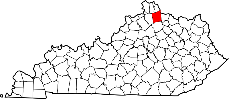
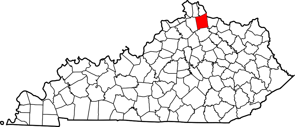
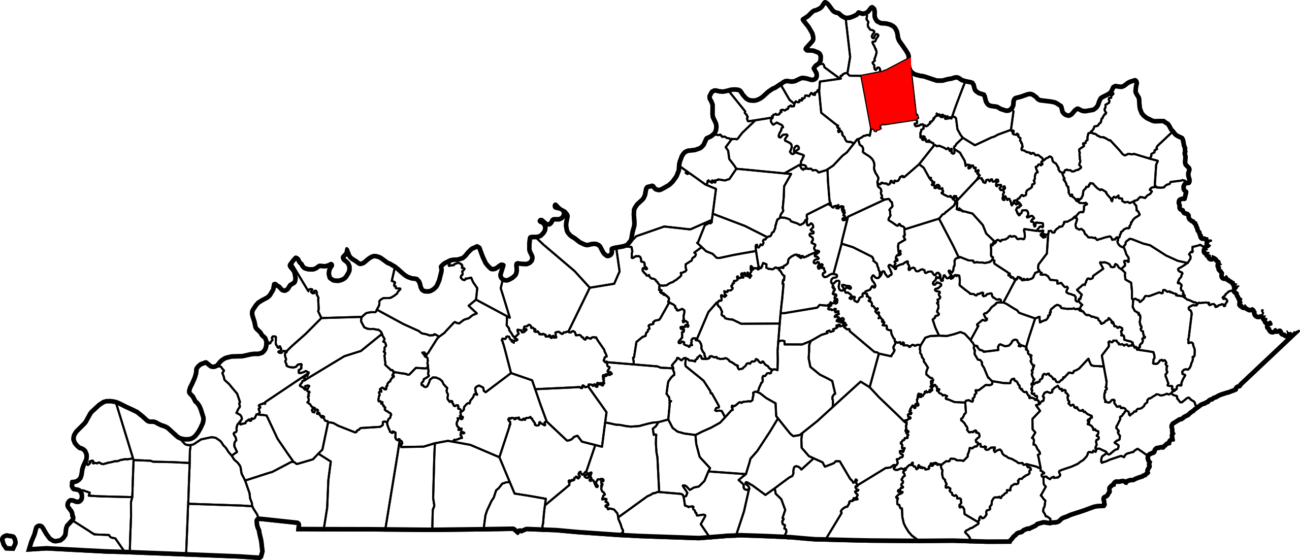
English: This is a locator map showing Pendleton County in Kentucky. For more information, see Commons:United States county locator maps. |
| Data | |
| Burimi |
Punë e juaja: English: The maps use data from nationalatlas.gov, specifically countyp020.tar.gz on the Raw Data Download page. The maps also use state outline data from statesp020.tar.gz. The Florida maps use hydrogm020.tar.gz to display Lake Okeechobee. |
| Autori | David Benbennick |
Licencim
| Unë,krijuesi i kësaj pune, e lëshoj këtë punë në public domain. Kjo aplikohet në të gjithë botën. Në disa vende kjo mund të mos jetë e mundur ligjërisht; nëse është kështu: Unë i garantoj çdokujt të drejtën për ta përdorur këtë punë për çdo qëllim, pa asnjë kusht, përveç rasteve kur këto kushte janë të kërkuara nga ligji. |
Historiku skedës
Shtypni mbi një datë/kohë për ta parë skedën siç ishte atëherë.
| Data/Koha | Miniaturë | Përmasat | Përdoruesi | Koment | |
|---|---|---|---|---|---|
| e tanishme | 12 shkurt 2006 14:24 | | 6.770 × 2.916 (127 KB) | David Benbennick | {{subst:User:Dbenbenn/clm|county=Pendleton County|state=Kentucky}} |
Lidhje skedash
S’ka faqe që përdorin këtë kartelë.
Përdorimi global i skedës
Kjo skedë përdoret nga Wiki të tjera në vijim:
- Përdorimi në ar.wikipedia.org
- Përdorimi në bg.wikipedia.org
- Përdorimi në bpy.wikipedia.org
- Përdorimi në cdo.wikipedia.org
- Përdorimi në ceb.wikipedia.org
- Përdorimi në ce.wikipedia.org
- Përdorimi në cs.wikipedia.org
- Përdorimi në cy.wikipedia.org
- Përdorimi në de.wikipedia.org
- Përdorimi në en.wikipedia.org
- Pendleton County, Kentucky
- Butler, Kentucky
- Falmouth, Kentucky
- Williamstown, Kentucky
- List of counties in Kentucky
- Kincaid Lake
- Template:Pendleton County, Kentucky
- User:Nyttend/County templates/KY/2
- National Register of Historic Places listings in Pendleton County, Kentucky
- DeMossville, Kentucky
- Category:Populated places in Pendleton County, Kentucky
- Peach Grove, Kentucky
- Bachelors Rest, Kentucky
- Flower Town, Kentucky
- Goforth, Kentucky
- Template:PendletonCountyKY-geo-stub
- Lenoxburg, Kentucky
- Carntown, Kentucky
- Stepstone Creek
- Përdorimi në es.wikipedia.org
- Përdorimi në et.wikipedia.org
- Përdorimi në eu.wikipedia.org
- Përdorimi në fa.wikipedia.org
- Përdorimi në fa.wikivoyage.org
- Përdorimi në frr.wikipedia.org
- Përdorimi në fr.wikipedia.org
- Përdorimi në hu.wikipedia.org
Shikoni më shumë përdorim global të kësaj skede.