Skeda:Montenegro motorways.JPG
Madhësia e këtij shikimi: 446 × 599 pixel. Rezolucione të tjera: 178 × 240 pixel | 357 × 480 pixel | 571 × 768 pixel | 762 × 1.024 pixel | 1.453 × 1.953 pixel.
Dokument origjinal ((përmasa 1.453 × 1.953 px, madhësia skedës: 458 KB, lloji MIME: image/jpeg))
| Kjo skedë është prej Wikimedia Commons dhe mund të përdoret nga projekte të tjera. Përshkrimi në këtë skedë në këtë faqe nuk është treguar më poshtë. | Shko tek faqja përshkruese në Commons |

|
Kjo transport map fotografi duhet duhen te behen edhe i here si nje SVG.
|


Përmbledhje
| Përshkrimi |
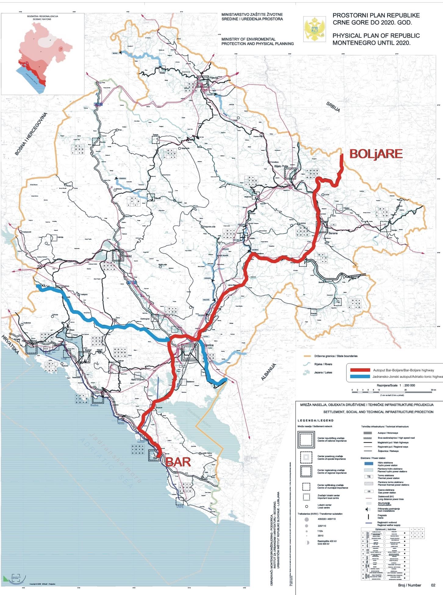
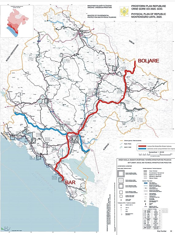
English: Excerpt from Spatial Plan of Montenegro for 2020.
Српски / srpski: Izvod iz Prostornog Plana Crne Gore do 2020 godine. |
| Data | |
| Burimi | Government of Montenegro |
| Autori | Government of Montenegro |
Licencim
Unë, krijuesi i kësaj pune, e publikoj këtu në bazë të licensës në vijim:
| Kjo skedë është bërë e mundur nën Creative Commons CC0 1.0 Universal Public Domain Dedication. | |
| Personi që lidhi një punë me këtë vepër ia ka dedikuar punën public domain duke shmangur të gjitha të drejtat e tij apo të saj për punën në mbarë botën nën ligjin e të drejtës së autorit, duke përfshirë të gjitha të drejtat e lidhura dhe fqinje, deri në masën e lejuar me ligj. Ju mund ta kopjoni, modifikoni, shpërndani dhe të kryeni pune, madje edhe për qëllime komerciale, të gjitha pa kërkuar leje.
|
Historiku skedës
Shtypni mbi një datë/kohë për ta parë skedën siç ishte atëherë.
| Data/Koha | Miniaturë | Përmasat | Përdoruesi | Koment | |
|---|---|---|---|---|---|
| e tanishme | 22 tetor 2010 15:37 | | 1.453 × 1.953 (458 KB) | Nije bitno... | {{Information |Description={{en|1=Excerpt from Spatial Plan of Montenegro for 2020. }} {{sr|1=Izvod iz Prostornog Plana Crne Gore do 2020 godine.}} |Source=Government of Montenegro |Author=Government of Montenegro |Date=2006-12-06 |Permission= |other_vers |
Lidhje skedash
Këto faqe lidhen tek kjo skedë:
Përdorimi global i skedës
Kjo skedë përdoret nga Wiki të tjera në vijim:
- Përdorimi në cs.wikipedia.org
- Përdorimi në de.wikipedia.org
- Përdorimi në en.wikipedia.org
- Përdorimi në hr.wikipedia.org
- Përdorimi në it.wikipedia.org
- Përdorimi në lv.wikipedia.org
- Përdorimi në mk.wikipedia.org
- Përdorimi në nl.wikipedia.org
- Përdorimi në pl.wikipedia.org
- Përdorimi në ro.wikipedia.org
- Përdorimi në ru.wikipedia.org
- Përdorimi në sr.wikipedia.org
- Përdorimi në te.wikipedia.org
- Përdorimi në uk.wikipedia.org
- Përdorimi në www.wikidata.org
- Përdorimi në zh.wikipedia.org