Skeda:Puducherry Electoral Constituencies Map.svg

Size of this PNG preview of this SVG file: 800 × 436 pixel. Rezolucione të tjera: 320 × 174 pixel | 640 × 349 pixel | 1.024 × 558 pixel | 1.280 × 697 pixel | 2.560 × 1.394 pixel | 1.493 × 813 pixel.
Dokument origjinal (skedë SVG, fillimisht 1.493 × 813 pixel, madhësia e skedës: 590 KB)
| Kjo skedë është prej Wikimedia Commons dhe mund të përdoret nga projekte të tjera. Përshkrimi në këtë skedë në këtë faqe nuk është treguar më poshtë. | Shko tek faqja përshkruese në Commons |
Përmbledhje
| Përshkrimi |
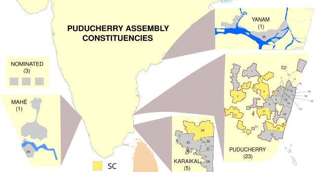
English: Map showing the electoral districts of the Union Territory of Puducherry, India. Uses File:Puducherry Map.svg (self made) as a base. Constituency maps for Puducherry and Karaikal recreated from File:Puducherry-Assembly-Constituencies-1-30-assembly-election-2011.png. |
| Data | 01/03/2021 |
| Burimi | Punë e juaja |
| Autori | RaviC |
Licencim
Unë, krijuesi i kësaj pune, e publikoj këtu në bazë të licensës në vijim:
Kjo skedë licencohet sipas Creative Commons Attribution-Share Alike 3.0 Unported.
- Je i lirë të:
- ta shpërndani – ta kopjoni, rishpërndani dhe përcillni punën
- t’i bëni “remix” – të përshtatni punën
- Sipas kushteve të mëposhtme:
- atribuim – Duhet t’i jepni meritat e duhura, të siguroni një lidhje për tek licenca dhe të tregoni nëse janë bërë ndryshime. Këtë mund ta bëni në ndonjë mënyrë të arsyeshme, por jo në ndonjë mënyrë që sugjeron se licencuesi ju del zot juve apo përdorimit tuaj.
- share alike – Nëse bëni një “remix”, e shndërroni, ose ndërtoni duke u bazuar te materiali, duhet t’i shpërndani kontributet tuaja sipas të njëjtës licencë ose një të tille të përputhshme me origjinalen.
Historiku skedës
Shtypni mbi një datë/kohë për ta parë skedën siç ishte atëherë.
| Data/Koha | Miniaturë | Përmasat | Përdoruesi | Koment | |
|---|---|---|---|---|---|
| e tanishme | 15 mars 2021 17:47 | | 1.493 × 813 (590 KB) | RaviC | Improved constituency boundaries for Puducherry district from File:Wahlkreise zur Vidhan Sabha von Puducherry.svg, added numbering |
| 1 mars 2021 14:11 |  | 1.493 × 813 (541 KB) | RaviC | more fixes | |
| 1 mars 2021 14:05 |  | 1.493 × 813 (543 KB) | RaviC | Yanam spelling // Editing SVG source code using c:User:Rillke/SVGedit.js | |
| 1 mars 2021 14:01 |  | 1.493 × 813 (543 KB) | RaviC | improvements | |
| 1 mars 2021 13:51 |  | 1.493 × 813 (543 KB) | RaviC | =={{int:filedesc}}== {{Information |description={{en|1=Map showing the electoral districts of the Union Territory of Puducherry, India. Uses File:Puducherry Map.svg (self made) as a base. Constituency maps for Puducherry and Karaikal recreated from Puducherry-Assembly-Constituencies-1-30-assembly-election-2011.png |date=01/03/2021 |source={{own}} |author=RaviC |permission= |other_versions= }} =={{int:license-header}}== {{self|cc-by-sa-3.0}} [[Category:SVG maps... |
Lidhje skedash
Këto faqe lidhen tek kjo skedë:
Përdorimi global i skedës
Kjo skedë përdoret nga Wiki të tjera në vijim:
- Përdorimi në en.wikipedia.org
- Përdorimi në mr.wikipedia.org
- Përdorimi në pnb.wikipedia.org
- Përdorimi në te.wikipedia.org
- Përdorimi në ur.wikipedia.org