Skeda:Serbia1817.png
Madhësia e këtij shikimi: 800 × 578 pixel. Rezolucione të tjera: 320 × 231 pixel | 640 × 462 pixel | 863 × 623 pixel.
Dokument origjinal ((përmasa 863 × 623 px, madhësia skedës: 62 KB, lloji MIME: image/png))
| Kjo skedë është prej Wikimedia Commons dhe mund të përdoret nga projekte të tjera. Përshkrimi në këtë skedë në këtë faqe nuk është treguar më poshtë. | Shko tek faqja përshkruese në Commons |
Përmbledhje
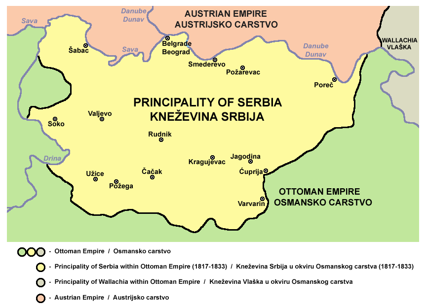
- Principality of Serbia in 1817.
- Kneževina Srbija 1817. godine.
Source and license

|
This map has been uploaded by Electionworld from en.wikipedia.org to enable the |
Self-made map by PANONIAN
| Kjo skedë është lëshuar në public domain nga autori i saj, PANONIAN. Kjo aplikohet në të gjithë botën. Në disa vende kjo mund të mos jetë e mundur ligjërisht; nëse është kështu: |
References
- Školski istorijski atlas, Zavod za izdavanje udžbenika SR Srbije, Beograd, 1970.
- Povijesni atlas, Učila - Zagreb, Zagreb, 1971.
- Dr Tomislav Bogavac, Nestajanje Srba, Niš, 1994.
- Istorijski atlas, Intersistem Kartografija, Beograd, 2010.
- Istorijski atlas, Geokarta, Beograd, 1999.
- Sima M. Ćirković, Srbi među evropskim narodima, Beograd, 2004.
- Sve srpske mape - od šestog veka do Pariza, Specijalno izdanje BLICA, Decembar 1995. godine.
- The Times History of Europe, Times Books, London, 2002.
- http://terkepek.adatbank.transindex.ro/kepek/netre/99.gif
- http://www.znanje.org/i/i21/01iv04/01iv0418/images/knezevina_srbija_1.jpg
- http://www.znanje.org/i/i21/01iv04/01iv0418/images/knezevina_srbija_3.jpg
- http://www.zum.de/whkmla/histatlas/balkans/Serbia%201813%20to%201918.gif
derivative works

|
File:Serbia1817.svg is a vector version of this file. It should be used in place of this PNG file when not inferior.
File:Serbia1817.png → File:Serbia1817.svg
For more information, see Help:SVG. |
 |
Historiku skedës
Shtypni mbi një datë/kohë për ta parë skedën siç ishte atëherë.
| Data/Koha | Miniaturë | Përmasat | Përdoruesi | Koment | |
|---|---|---|---|---|---|
| e tanishme | 15 tetor 2012 00:06 | | 863 × 623 (62 KB) | PANONIAN | {{Information |Description ={{en|1=improved my own work}} |Source =improved my own work |Author =improved my own work |Date = |Permission = |other_versions = }} |
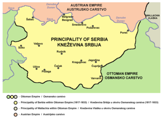
| 21 dhjetor 2006 23:39 |  | 597 × 460 (11 KB) | Electionworld | {{ew|en|PANONIAN}} Self-made map by PANONIAN {{PD-user|PANONIAN}} Category:Maps of Serbia |
Lidhje skedash
Këto faqe lidhen tek kjo skedë:
Përdorimi global i skedës
Kjo skedë përdoret nga Wiki të tjera në vijim:
- Përdorimi në ar.wikipedia.org
- Përdorimi në az.wikipedia.org
- Përdorimi në ba.wikipedia.org
- Përdorimi në be-tarask.wikipedia.org
- Përdorimi në be.wikipedia.org
- Përdorimi në bg.wikipedia.org
- Përdorimi në ca.wikipedia.org
- Përdorimi në cs.wikipedia.org
- Përdorimi në de.wikipedia.org
- Përdorimi në el.wikipedia.org
- Përdorimi në en.wikipedia.org
- Përdorimi në et.wikipedia.org
- Përdorimi në fr.wikipedia.org
- Përdorimi në gl.wikipedia.org
- Përdorimi në he.wikipedia.org
- Përdorimi në hr.wikipedia.org
- Përdorimi në hu.wikipedia.org
- Përdorimi në hy.wikipedia.org
- Përdorimi në id.wikipedia.org
- Përdorimi në it.wikipedia.org
- Përdorimi në ja.wikipedia.org
- Përdorimi në ka.wikipedia.org
- Përdorimi në lv.wikipedia.org
- Përdorimi në mk.wikipedia.org
- Përdorimi në nl.wikipedia.org
- Përdorimi në pl.wikipedia.org
- Përdorimi në pnb.wikipedia.org
Shikoni më shumë përdorim global të kësaj skede.