Skeda:Soviet Union Administrative Divisions 1989.jpg

Madhësia e këtij shikimi: 800 × 557 pixel. Rezolucione të tjera: 320 × 223 pixel | 640 × 445 pixel | 1.024 × 713 pixel | 1.280 × 891 pixel | 1.887 × 1.313 pixel.
Dokument origjinal ((përmasa 1.887 × 1.313 px, madhësia skedës: 397 KB, lloji MIME: image/jpeg))
| Kjo skedë është prej Wikimedia Commons dhe mund të përdoret nga projekte të tjera. Përshkrimi në këtë skedë në këtë faqe nuk është treguar më poshtë. | Shko tek faqja përshkruese në Commons |
Përmbledhje
| Përshkrimi |
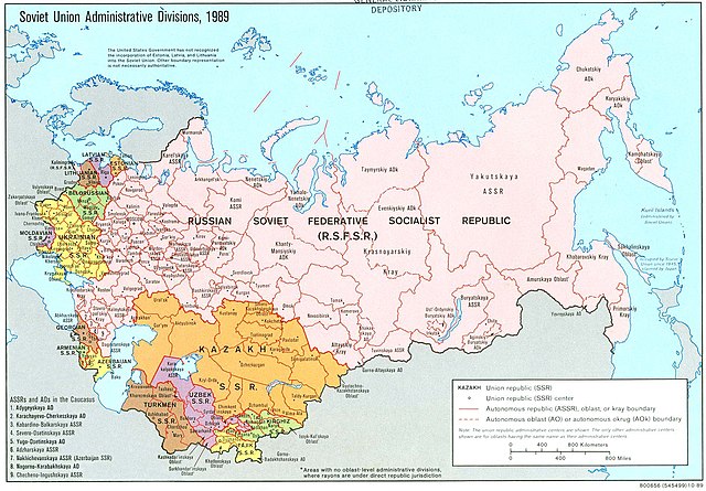
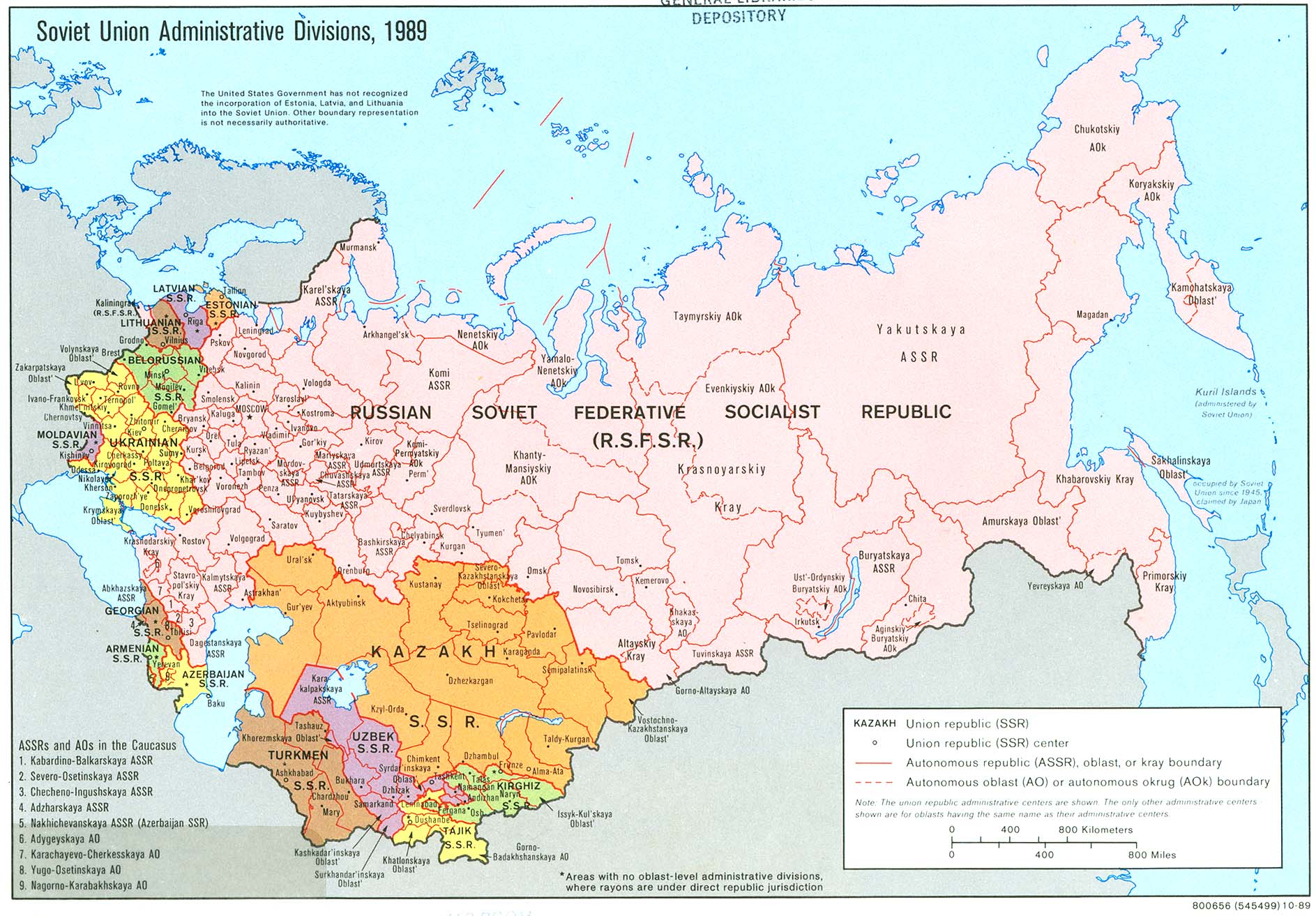
English: An American map of Soviet Union Administrative Divisions c.1989 |
||
| Burimi |
|
||
| Autori | |||
| Versione tjera |
|


Licencim
| This work is from the Library of Congress. According to the library, there are no known copyright restrictions on the use of this work. |  |
Historiku skedës
Shtypni mbi një datë/kohë për ta parë skedën siç ishte atëherë.
| Data/Koha | Miniaturë | Përmasat | Përdoruesi | Koment | |
|---|---|---|---|---|---|
| e tanishme | 17 maj 2019 16:21 | | 1.887 × 1.313 (397 KB) | Claude Zygiel | Removed stains |
| 17 dhjetor 2006 09:39 |  | 1.887 × 1.313 (413 KB) | Electionworld | {{ew|en|Ma GioZal}} Soviet Union administrative divisions (republics) and sub-divisions (oblasts, autonomous republics, autonomous districs, etc.) in the year 1989, the last before the process of independence of Soviet republics after the [[Berlin Wa |
Lidhje skedash
Këto faqe lidhen tek kjo skedë:
Përdorimi global i skedës
Kjo skedë përdoret nga Wiki të tjera në vijim:
- Përdorimi në af.wikipedia.org
- Përdorimi në ar.wikipedia.org
- Përdorimi në ast.wikipedia.org
- Përdorimi në azb.wikipedia.org
- Përdorimi në az.wikipedia.org
- Përdorimi në az.wiktionary.org
- Përdorimi në bg.wikipedia.org
- Përdorimi në ca.wikipedia.org
- Përdorimi në cs.wikipedia.org
- Përdorimi në en.wikipedia.org
- History of the Soviet Union (1982–1991)
- History of Russia
- Soviet Union
- Republics of the Soviet Union
- Buryats
- Ukrainian Soviet Socialist Republic
- Uzbek Soviet Socialist Republic
- Republics of Russia
- Soviet people
- Portal:Maps/Maps/Political
- Portal:Maps/Maps/Political/8
- User:Seryo93/USSR
- Russian Soviet Federative Socialist Republic
- Portal:Soviet Union
- Great Russian chauvinism
- Russia–Ukraine border
- Russian imperialism
- User:Falcaorib
- Përdorimi në en.wikiquote.org
- Përdorimi në es.wikipedia.org
- Përdorimi në fa.wikipedia.org
- Përdorimi në fi.wikipedia.org
Shikoni më shumë përdorim global të kësaj skede.