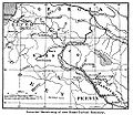
Skeda:TreatyofKarsMap.jpg

Madhësia e këtij shikimi: 694 × 600 pixel. Rezolucione të tjera: 278 × 240 pixel | 556 × 480 pixel | 1.000 × 864 pixel.
Dokument origjinal ((përmasa 1.000 × 864 px, madhësia skedës: 404 KB, lloji MIME: image/jpeg))
Historiku skedës
Shtypni mbi një datë/kohë për ta parë skedën siç ishte atëherë.
| Data/Koha | Miniaturë | Përmasat | Përdoruesi | Koment | |
|---|---|---|---|---|---|
| e tanishme | 3 mars 2007 23:14 |  | 1.000 × 864 (404 KB) | Aivazovsky~commonswiki |
Lidhje skedash
Këto faqe lidhen tek kjo skedë:
Përdorimi global i skedës
Kjo skedë përdoret nga Wiki të tjera në vijim:
- Përdorimi në azb.wikipedia.org
- Përdorimi në az.wikipedia.org
- Përdorimi në ba.wikipedia.org
- Përdorimi në be.wikipedia.org
- Përdorimi në ca.wikipedia.org
- Përdorimi në cs.wikipedia.org
- Përdorimi në de.wikipedia.org
- Përdorimi në el.wikipedia.org
- Përdorimi në en.wikipedia.org
- Përdorimi në fi.wikipedia.org
- Përdorimi në fr.wikipedia.org
- Përdorimi në hy.wikipedia.org
- Përdorimi në hyw.wikipedia.org
- Përdorimi në it.wikipedia.org
- Përdorimi në ja.wikipedia.org
- Përdorimi në kk.wikipedia.org
- Përdorimi në krc.wikipedia.org
- Përdorimi në lt.wikipedia.org
- Përdorimi në mk.wikipedia.org
- Përdorimi në nl.wikipedia.org
- Përdorimi në pl.wikipedia.org
- Përdorimi në pt.wikipedia.org
- Përdorimi në ro.wikipedia.org
- Përdorimi në ru.wikipedia.org
- Përdorimi në ru.wikiversity.org
- Përdorimi në sr.wikipedia.org
- Përdorimi në tr.wikipedia.org
- Përdorimi në uk.wikipedia.org
- Përdorimi në zh.wikipedia.org
