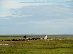
Yamalo-Nenets Autonomous Okrug
federal subject of Russia, administered by Tyumen Oblast
instancë e
pjesë e
Ural Federal District
fillimi
10 dhjetor 1930
emërtimi në gjuhën amë
Ямало-Ненецкий автономный округ
Ямалы-Ненёцие автономной ӈокрук
gjuha e veprës ose emrit: Nenets
emër i shkurtër
ЯНАО
himni
Anthem of Yamalo-Nenets Autonomous Okrug
audio:
shteti
Rusia
koha e fillimit: 26 dhjetor 1991
kryeqytet
Salekhard[9]
e vendosur në entitetin territorial administrativ të
Tyumen Oblast
koha e fillimit: 14 gusht 1944
koordinatat
geoshape
office held by head of government
head of the region (Russia)
kryetar i qeverisjes
Dmitriy Nikolaevitsj Kobilkin
Dmitry Artyukhov
legjislative
Legislative Assembly of the Yamalo-Nenets Autonomous Okrug
popullsia
515.960
data: 2024
replaces
Tobol Okrug
language used
Nenets
Khanty
Selkup
sipërfaqja
683.976 kilometër katror
webfaqja zyrtare
http://правительство.янао.рф/
gjuha e veprës ose emrit: rusisht
flamur
flag of Yamalo-Nenets Autonomous Okrug
stemën
coat of arms of Yamalo-Nenets Autonomous Okrug
përshkruar nga burimi
Малая советская энциклопедия, 1936—1947
deklarata është subjekt i: Q87326080
kodi i targës
89
Galeria në Commons
Ямало-Ненецкий автономный округ
kategoria në Commons
Yamalo-Nenets Autonomous Okrug
kategoria kryesore
Category:Yamalo-Nenets Autonomous Okrug
category of associated people
Category:People from Yamalo-Nenets Autonomous Okrug
kategoria e njerëzve të lindur këtu
Q8080610
category for people who died here
Q32247900
category for maps
Category:Maps of Yamalo-Nenets Autonomous Okrug
Reference
- ^ Freebase Data Dumps, 28 tetor 2013
- ^ BabelNet
- ^ Czech National Authority Database, 19 mars 2020, ge634873
- ^ GeoNames
- ^ MusicBrainz
- ^ OKATO, 2 gusht 2013
- ^ KBpedia, 9 korrik 2020
- ^ iNaturalist, 25 prill 2021, https://www.inaturalist.org/places/inaturalist-places.csv.zip
- ^ Q87326080
- ^ https://data.iana.org/time-zones/tzdb-2021e/europe


