Skeda:Cardiff UK location map.svg

Size of this PNG preview of this SVG file: 562 × 599 pixel. Rezolucione të tjera: 225 × 240 pixel | 450 × 480 pixel | 720 × 768 pixel | 960 × 1.024 pixel | 1.920 × 2.048 pixel | 1.187 × 1.266 pixel.
Dokument origjinal (skedë SVG, fillimisht 1.187 × 1.266 pixel, madhësia e skedës: 464 KB)
| Kjo skedë është prej Wikimedia Commons dhe mund të përdoret nga projekte të tjera. Përshkrimi në këtë skedë në këtë faqe nuk është treguar më poshtë. | Shko tek faqja përshkruese në Commons |
| Përshkrimi |
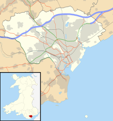
Blank map of Cardiff, UK with the following information shown:
Equirectangular map projection on WGS 84 datum, with N/S stretched 160% Geographic limits:
|
| Data | |
| Burimi |
|
| Autori | Nilfanion, created using Ordnance Survey data |
| Leja (Ripërdor këtë skedë) |
Kjo skedë licencohet sipas Creative Commons Attribution-Share Alike 3.0 Unported. Atribuim: Contains Ordnance Survey data © Crown copyright and database right
|
| Versione tjera | File:Cardiff UK map.svg - Blank map |
Historiku skedës
Shtypni mbi një datë/kohë për ta parë skedën siç ishte atëherë.
| Data/Koha | Miniaturë | Përmasat | Përdoruesi | Koment | |
|---|---|---|---|---|---|
| e tanishme | 26 shtator 2010 21:29 | | 1.187 × 1.266 (464 KB) | Nilfanion | {{Information |Description=Blank map of Cardiff, UK with the following information shown: *Administrative borders *Coastline, lakes and rivers *Roads and railways *Urban areas Equirectangular map projection on WGS 84 datum, with N/S stretch |
Lidhje skedash
Këto faqe lidhen tek kjo skedë:
Përdorimi global i skedës
Kjo skedë përdoret nga Wiki të tjera në vijim:
- Përdorimi në ar.wikipedia.org
- Përdorimi në arz.wikipedia.org
- Përdorimi në bh.wikipedia.org
- Përdorimi në bn.wikipedia.org
- Përdorimi në ceb.wikipedia.org
- Përdorimi në cy.wikipedia.org
- Përdorimi në da.wikipedia.org
- Përdorimi në el.wikipedia.org
- Përdorimi në en.wikipedia.org
- Cardiff
- Llandaff
- Llandaff Cathedral
- Cardiff Castle
- List of monastic houses in Wales
- Thornhill, Cardiff
- Cardiff Bay
- Castell Coch
- Gwaelod-y-Garth
- Rhiwbina
- Tremorfa
- Llanrumney
- Cathays
- St Fagans
- Lisvane
- Radyr
- Gabalfa
- Mynachdy
- Cyncoed
- St Mellons
- Michaelston-super-Ely
- Adamsdown
- Cardiff city centre
- Whitchurch, Cardiff
- St Fagans National Museum of History
- Pentyrch
- Ely, Cardiff
- Canton, Cardiff
- Birchgrove, Cardiff
- The Point, Cardiff
- Coal Exchange
- Tongwynlais
- University Hospital of Wales
- Rhydlafar
- Cardiff West services
- Rookwood Hospital
- Pontprennau
- Cardiff Gate services
- Caerau, Cardiff
- Cardiff Royal Infirmary
Shikoni më shumë përdorim global të kësaj skede.