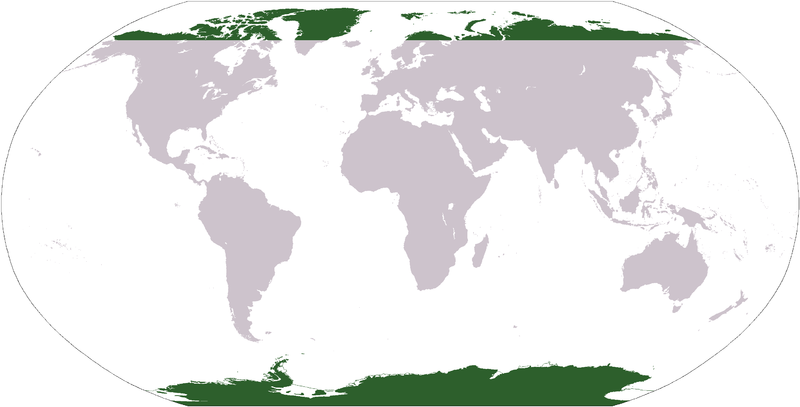
Skeda:LocationPolarRegions.png

Madhësia e këtij shikimi: 800 × 407 pixel. Rezolucione të tjera: 320 × 163 pixel | 640 × 326 pixel | 1.024 × 521 pixel | 1.280 × 651 pixel | 2.759 × 1.404 pixel.
Dokument origjinal ((përmasa 2.759 × 1.404 px, madhësia skedës: 92 KB, lloji MIME: image/png))
Historiku skedës
Shtypni mbi një datë/kohë për ta parë skedën siç ishte atëherë.
| Data/Koha | Miniaturë | Përmasat | Përdoruesi | Koment | |
|---|---|---|---|---|---|
| e tanishme | 29 janar 2016 00:19 |  | 2.759 × 1.404 (92 KB) | Foghe | Isle ? (green --> gray) |
| 31 mars 2006 06:31 |  | 2.759 × 1.404 (51 KB) | E Pluribus Anthony~commonswiki | Map indicating the world's polar regions (i.e. Antarctica and area within Arctic Circle), derived on Image:LocationAntarctica.png | |
| 31 mars 2006 05:42 |  | 2.759 × 1.404 (55 KB) | David Kernow~commonswiki | Map indicating the world's polar regions (i.e. Antarctica and area within Arctic Circle), derived on Image:LocationAntarctica.png. |
Lidhje skedash
Këto faqe lidhen tek kjo skedë:
Përdorimi global i skedës
Kjo skedë përdoret nga Wiki të tjera në vijim:
- Përdorimi në af.wikipedia.org
- Australasië
- Midde-Ooste
- Sentraal-Amerika
- Atlantiese Oseaan
- Suider-Afrika
- Indiese Oseaan
- Suidelike Oseaan
- Arktiese Oseaan
- Stille Oseaan
- Latyns-Amerika
- Oos-Asië
- Sjabloon:Gebiede van die wêreld
- Noord-Europa
- Melanesië
- Mikronesië
- Polinesië
- Oos-Afrika
- Wes-Afrika
- Noord-Afrika
- Oos-Europa
- Verre Ooste
- Sentraal-Afrika
- Afrika suid van die Sahara
- Seelandië
- Noordpoolgebied
- Karibiese gebied
- Indiese subkontinent
- Suidoos-Asië
- Wes-Asië
- Wes-Europa
- Suid-Europa
- Suid-Asië
- Sentraal-Asië
- Sentraal-Europa
- Suidoos-Europa
- Noord-Asië
- Përdorimi në ar.wikipedia.org
Shikoni më shumë përdorim global të kësaj skede.

